May 2026
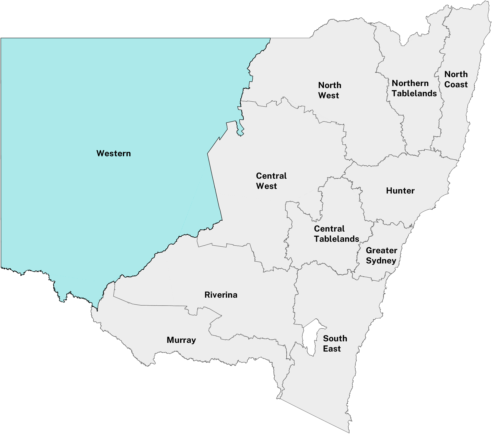 Western Local Land Services
High variability in conditions across the region
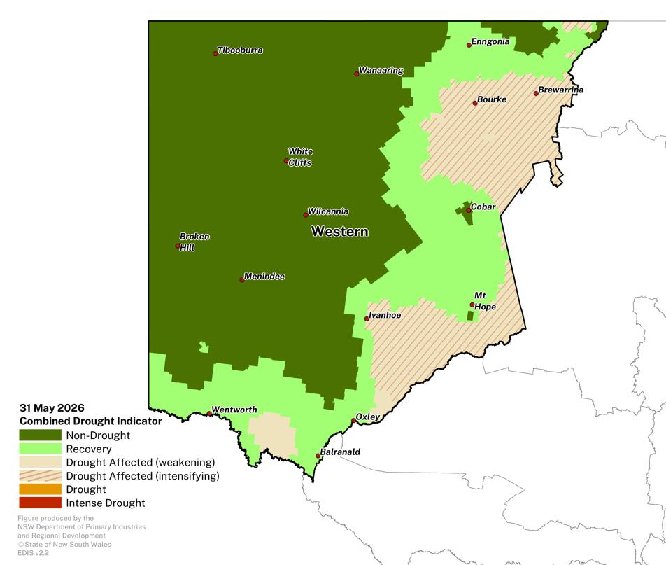
- Autumn rainfall has been above average in the far west, with on-ground reports suggesting that this has supported pasture growth in regions such as Broken Hill, Pooncarie and the Corner Country. Much of the western region remains in the NSW-CDI Non-Drought category.
- Despite these improvements, large areas of the LLS region continue to manage the impacts of long-term rainfall deficits. This includes regions around Ivanhoe, Bourke and Hillston. Rainfall has been variable and not sufficient to significantly shift conditions or trigger drought recovery.
- Reports available suggest that many producers continue to monitor conditions as they adjust planning and management decisions, particularly around stocking rates and feed availability.
Click on the scroll bar below the map to compare with previous months.
The most likely outcome from DPIRD’s drought forecast is for an expansion of the area in the Non-Drought category at the end of August 2026 (issued 31 May 2026).
- Further recovery is likely for some areas around Cobar and Ivanhoe, and likely transition into the Non-Drought category.
- Other areas are likely to remain or transition to the Drought Affected category (e.g, Bourke and Mount Hope regions).
- There is low to high model agreement and low to moderate past accuracy for this forecast period.
| NSW-CDI Category | April 2026 | May 2026 |
|---|---|---|
| Non-Drought | 60.4% | 60.9% |
| Recovery | 9.5% | 23.0% |
| Drought Affected - Weakening | 15.6% | 1.4% |
| Drought Affected - Intensifying | 14.5% | 14.6% |
| Drought | 0.0% | 0.0% |
| Intense Drought | 0.0% | 0.0% |
Normalised Difference Vegetation Index
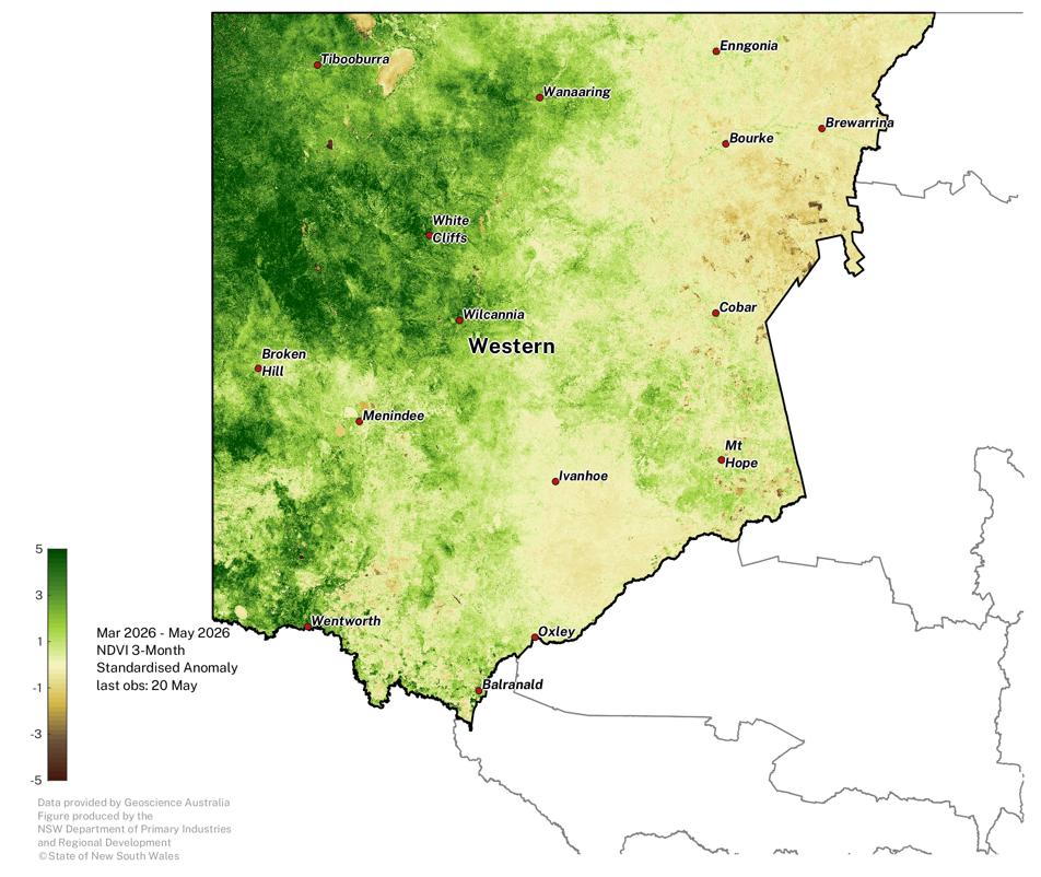
Plant greenness levels are variable across the region.
- The ongoing influence of follow-up autumn rainfall has improved plant greenness levels for large areas across region.
- Anomalies remain below average for some areas, particularly in the east and southeast of the region.
- The full influence of rainfall in late May will be available in the next Update.
- The spatial pattern of higher plant greenness is similar to the NSW CDI Non-Drought category, however the NDVI data is more detailed and captures local farm-to-farm variability as well as Total Grazing Pressure.
- The NDVI provides an important analysis for western NSW as it provides more detailed on-ground insight than the assessment built on climate observations alone.
- Note that some of the extremely negative NDVI areas (brown patches) are water bodies.
The NDVI anomaly is a useful measure of vegetation density and plant health. It estimates the amount of green vegetation there is in the landscape compared to what is expected at the given time of year, against the baseline period 1987 - 2020.
Click on the scroll bar below the map to compare with previous months.
Individual Drought Indicators
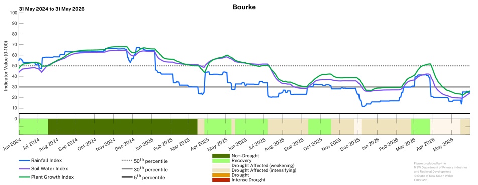
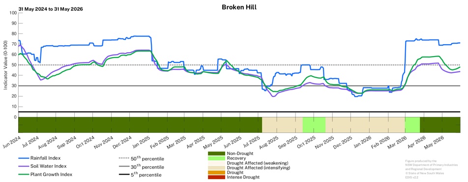
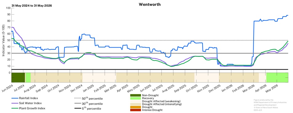
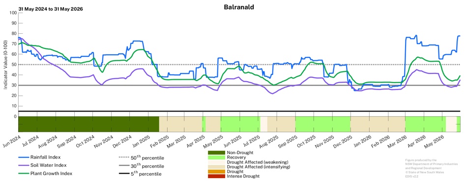
The drought indicators continue to remain variable across the region, with continued responses to rainfall observed.
- The underlying indicators have responded to recent rainfall events (particularly the Rainfall indicator) at all locations., with regions such as Balranald transitioning into the NSW-CDI Recovery category at the end of May. Further rainfall will build on these recent improvements.
- In other parts of the region, additional follow-up rainfall is needed to improve soil moisture and provide greater certainty for a transition to recovery.
- DPIRD continues to monitor conditions across the Western LLS region closely.
Observing the trends of the underlying drought indicators of Soil Water, Plant Growth and Rainfall is useful in tracking long-term changes in conditions.
Find out more about the underlying drought indicators here: https://www.dpird.nsw.gov.au/climate_applications/interactive-drought-map/Learn-more/understanding-the-cdi-phases
To access a Drought History chart for your Parish, visit the Seasonal Conditions Information Portal.