Barriers to fish passage
Australian native fish require unimpeded access along waterways in order to survive and reproduce. Both fresh and saltwater fish move within waters at different times to access food and shelter, to avoid predators, and to seek out mates. Of the 83 species of freshwater fish in south eastern Australia, over half migrate at least once as part of their life cycle. Some species can migrate thousands of kilometres while others only move a short distance.
Barriers to fish passage prevent the migration of native fish species and can have severe implications for these populations. In extreme cases, barriers can result in localised extinctions. This has occurred for Golden Perch populations above several large weirs and dams.
Types of barriers

Barriers can be:
- physical structures (e.g. weirs, dams, causeways and floodgates)
- hydraulic (e.g. areas of high velocity flow or turbulence)
- chemical (e.g. pollution plumes, acid sulfate soil discharge and low dissolved oxygen slugs)
- behavioural obstructions (e.g. dark tunnels or unnatural substrates created by pipes).
Habitats where food and shelter are degraded may also impact upon the migration of native fish species.
Fish passage barriers can adversely impact native fish by:
- interrupting spawning or seasonal migrations
- restricting access to preferred habitat and food resources
- increasing the chance of predation and disease
- reducing genetic flow between populations through population fragmentation.
The cumulative effect of barriers to fish passage has been identified in NSW as a Key Threatening Process under the Fisheries Management Act 1994 as the installation and operation of instream structures threatens the survival of native fish.
Video: Fish such as Spangled Perch and Eel-tailed Catfish are blocked from moving upstream by this weir on the upper Darling River.
More about the types of barriers


Identified NSW fish passage barriers
NSW Department of Primary Industries and Regional Development Fisheries and Forestry (DPIRD Fisheries) has worked with local councils and Local Land Services (previously Catchment Management Authorities) to develop a database of problem road crossings, weirs and floodgates that are barriers to fish passage. This information is now available online through our Spatial Data Portal.
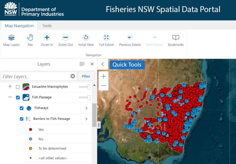
The database now includes the location of over 13,800 in stream structures within Key Fish Habitat. The data is fully downloadable as a shapefile from the NSW Fisheries Spatial Data Portal under a Creative Commons licence requiring credit be provided to DPIRD Fisheries.
The database is an ongoing initiative. As such, it will contain errors, omissions and outdated information. The accuracy will continue to improve as updates are made, feedback is gained, and new sites are added bi-annually or as required.
If you find a barrier to fish passage that is not showing on the spatial data portal, please report a barrier by following this link or scanning the QR code below and choosing "open in web browser".
If you are having difficulties doing this, you can always report a barrier to fish passage by getting in touch with your local fisheries manager at fish.passage@dpi.nsw.gov.au.