How does EDIS work?
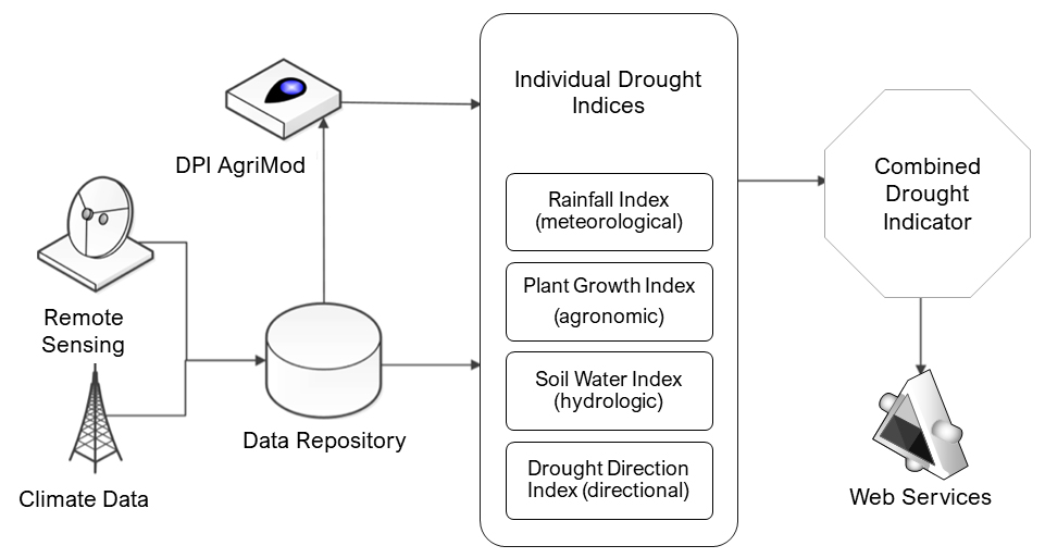
The Enhanced Drought Information SystemTM (EDIS) is an automated computing process that takes in climate observations and remote sensing data from a range of sources. The primary climate data source for EDIS is the national climate network which feeds the production of regular 1km2 climate data across Australia. The 1km2 data is ANUClimate, developed by the Australian National University. The climate data for NSW is processed through the DPI AgriMod crop-climate soil water balance model and used to calculate meteorologic, hydrologic, and agronomic drought indices for the state.
These indices combine to form the NSW Combined Drought Indicator (CDI), classifying seasonal conditions as five phases of drought. New data for the CDI arrives every day, but this is for four days prior to the current date to allow time for data transfer from the field and quality control. Summary outputs are pushed to the cloud for web-services, or to a data portal providing open access.
Technical schematic of the Enhanced Drought Information System (EDIS) used to calculate the NSW Combined Drought Indicator.